


0 of 0
")
")
")
")
")
About this mod
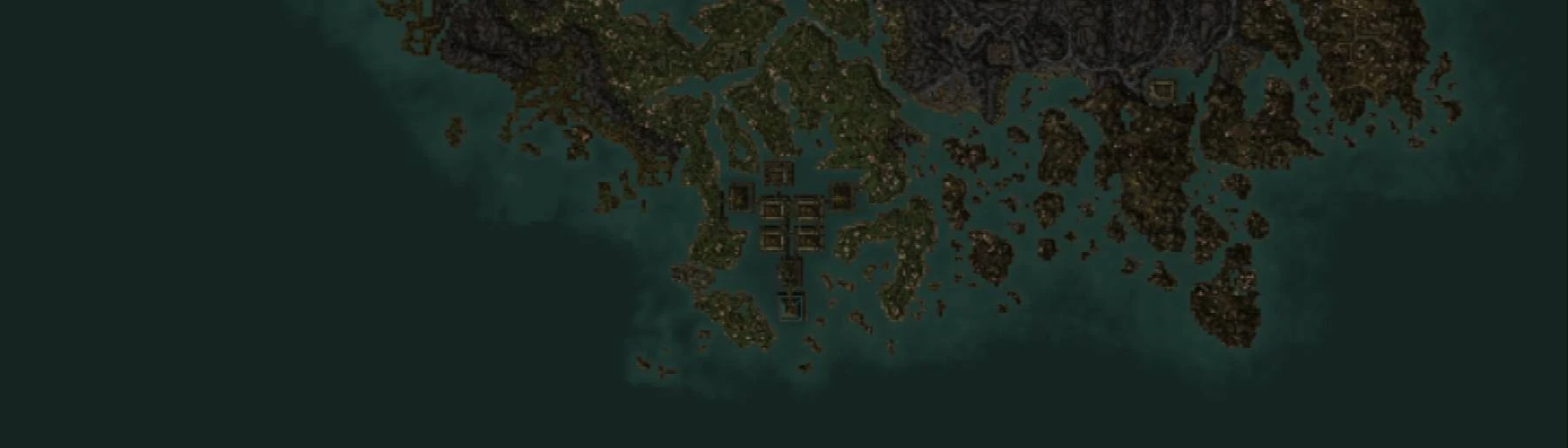
Vivec and Molag Mar no longer look like empty water on the global map.
- Permissions and credits
- Changelogs
This mod makes the cantons of Vivec and Molag Mar visible on the global map. It's compatible with other mods that edit those cells, as long as they don't change the landscape.
How it works: when TES Construction Set saves a cell's landscape data, it also precalculates some extra information which the game engine will need at runtime. One of those extra subrecords, called WNAM, stores the 9 by 9-pixel preview which represents the cell on the global map. Landscape records are separate from cell records (which contain all of the objects, NPCs, and things like the cell's name), and WNAMs normally don't show any of the objects in the cell. Not even gigantic, landscape-dominating megastructure objects like the cantons. This plugin adds modified WNAM data for the 15 cells which contain part of a canton, the high fane platform, or the palace of Vivec, causing the map to look as though there are canton-shaped hills in those places, without changing the actual landscape.
Compatibility: To my knowledge, there is no way to package just the WNAM subrecords, which means this mod must also reset the actual landscapes in Vivec and Molag Mar to their shapes in the base game. Installing this mod together with anything else that changes the landscapes in those cells, or a neighboring cell, might result in mismatched cell borders ("landscape tearing").
FAQs:
Is it compatible with my favorite landscape overhaul? I have no idea. I don't use any.
Will you make a patch for my favorite landscape overhaul? No. Not anytime soon. This was a huge pain the neck.
Does it work with OpenMW? I tested it in 0.47 stable, and it worked fine.
Does it work with TES3MP? I haven't tested, but I would assume so.
Can I install it on an existing save? Probably. You might have to revisit Vivec and Molag Mar to force the global map to update, though.
What tools do I need if I want to do something like this myself? I designed the new WNAMs in a spreadsheet. Then I manually transcribed the new height values into the original WNAM records using Enchanted Editor. Note that the 81 bytes in a WNAM record, when read from start to finish, represent a 9x9 grid in left to right, bottom to top order (flipped from how the cell appears on the map). Additionally, Enchanted Editor shows the data in a table with 10 columns, not 9. This makes the transcription process really confusing and error-prone.