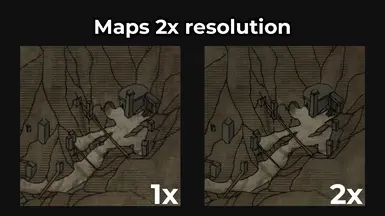
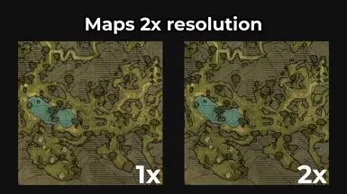
Hi! Which tool did you use to get that razor-sharp images from the dds maps? When I zoom into TAK_map.dds in irfanview for example the huts have a thick black outline while in your maps it's thin lines. Excellent!
Thank you! I exported DDS files as PNG and then upscaled it using upscale.media by PixelBin.io. After that I have to redone some things to make it better in Photoshop.


2 comments
When I zoom into TAK_map.dds in irfanview for example the huts have a thick black outline while in your maps it's thin lines.
Excellent!
After that I have to redone some things to make it better in Photoshop.