


0 of 0
About this mod
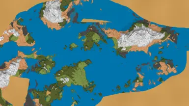
This mod makes it so reading a Cartography Table will also save a PNG file on your computer of the explored parts of your world map. Designed to create a reference map for "No Map" playthroughs, but will work for regular playthroughs just as well.
- Permissions and credits
- Changelogs
When installed reading the Cartography Table will also save a simplified map to your computer's hard drive. This mod was designed to enhance no-map playthroughs by drawing a static map for players to look at that shows their exploration progress without the spoiler of live updates.
Works in no-map mode to give Cartography Tables a fresh purpose, or in normal mode to get an alternate map style. I don't judge.
Compatibility:
-Simple enough it should be compatible with any other mods.
Config File:
-Copy and paste which directory you want your saves to appear in. Leaving the field blank will save files to Valheim's screenshots folder.
- Set the resolution you want your maps to have with the "scale" setting. Only 1, 2 or 3 are recommended. Higher values may be used for even higher resolution, but performance will suffer greatly and results are not guaranteed. For example, scale 4 images are too large for MS Paint to open.
- FogFill will generate filler data for unexplored areas that have been circumnavigated. This data is fudged based on what has been explored along the perimeter. Setting is "Partial" or "Full", but both currently do the same thing. Any other word will disable the feature.
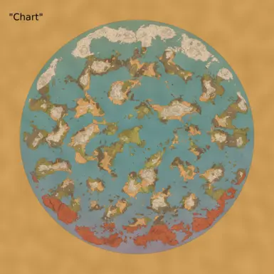
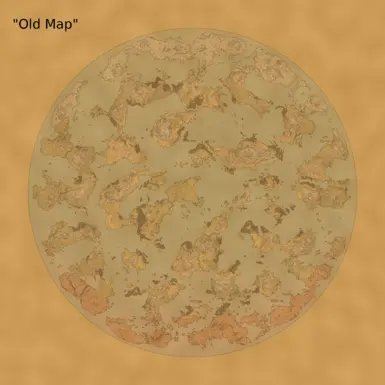
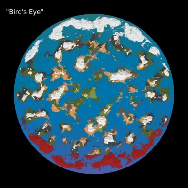
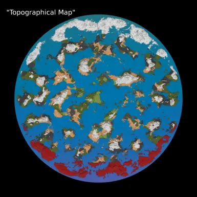
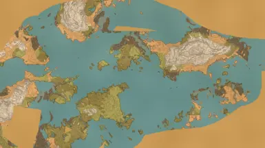
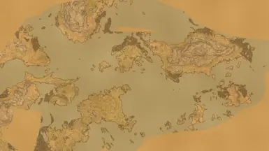
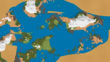
- Choose which of five map types you want. Only "Chart" is enabled by default.
Install:
It's a BepInEx mod. Just drop it in the BepInEx/plugins folder and you're good to go. Like all other BepInEx mods the config file gets generated the first time you run the game with the mod installed.
Use:
I recommend using image editing software that supports layers. I put the output from this mod in the bottom layer and draw roads and markers on the layers above it. Then when I reprint my maps I just swap the bottom layer out with the new image. Works like a charm!
Tech Support:
I'm not on the 'heim these days, or checking this mod's comments very often. For faster tech support you can DM me on reddit: u/A_Spy_
Works in no-map mode to give Cartography Tables a fresh purpose, or in normal mode to get an alternate map style. I don't judge.
Compatibility:
-Simple enough it should be compatible with any other mods.
Config File:
-Copy and paste which directory you want your saves to appear in. Leaving the field blank will save files to Valheim's screenshots folder.
- Set the resolution you want your maps to have with the "scale" setting. Only 1, 2 or 3 are recommended. Higher values may be used for even higher resolution, but performance will suffer greatly and results are not guaranteed. For example, scale 4 images are too large for MS Paint to open.
- FogFill will generate filler data for unexplored areas that have been circumnavigated. This data is fudged based on what has been explored along the perimeter. Setting is "Partial" or "Full", but both currently do the same thing. Any other word will disable the feature.
- Choose which of five map types you want. Only "Chart" is enabled by default.
Install:
It's a BepInEx mod. Just drop it in the BepInEx/plugins folder and you're good to go. Like all other BepInEx mods the config file gets generated the first time you run the game with the mod installed.
Use:
I recommend using image editing software that supports layers. I put the output from this mod in the bottom layer and draw roads and markers on the layers above it. Then when I reprint my maps I just swap the bottom layer out with the new image. Works like a charm!
Tech Support:
I'm not on the 'heim these days, or checking this mod's comments very often. For faster tech support you can DM me on reddit: u/A_Spy_