


0 of 0
About this mod
This add-on includes an overhauled representation of the Pre-Hispanic City of Teotihuacán, a World Heritage Site located a short distance west of the MMYK airport in Mexico.
- Permissions and credits
- Changelogs
- Donations
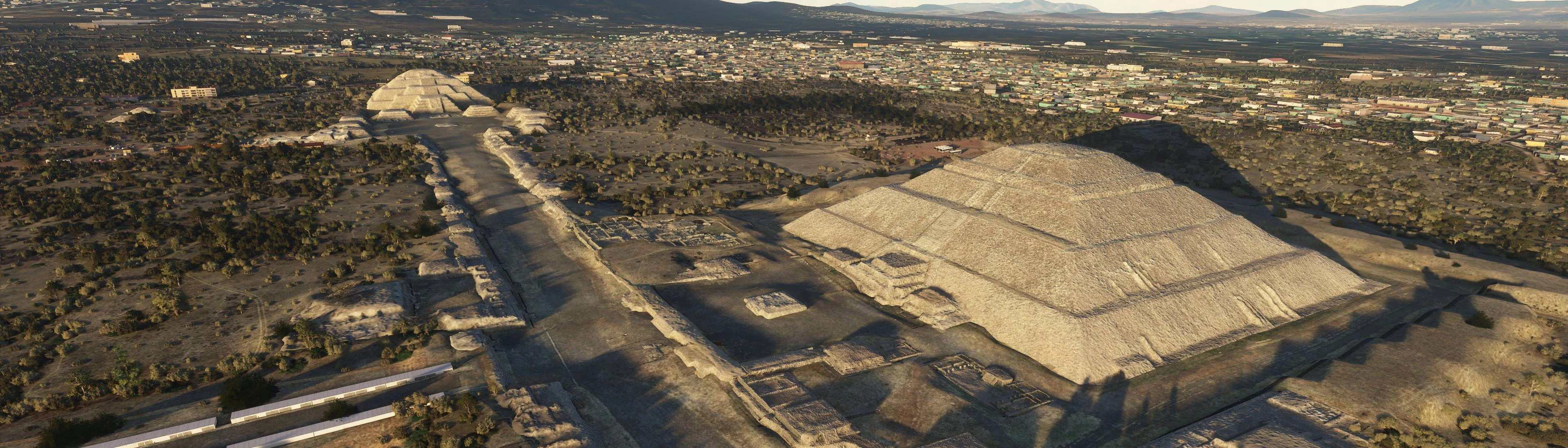
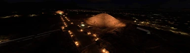
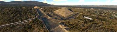
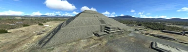
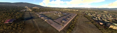
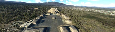
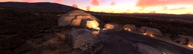
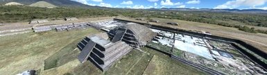
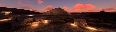
The default scenery for the Pre-Hispanic City of Teotihuacán is somewhat lacking. Due to the lack of custom models and Bing photogrammetry for this area, the Blackshark AI attempts to construct the site automatically by interpreting the 2D satellite imagery. However, as users will note, significant structures like the Pyramid of the Sun are represented by large warehouses or other anachronistic structures.
This add-on attempts to address this issue by presenting users with a much improved, and far more accurate overhaul of Teotihuacán. In addition to various ruins, this add-on includes the major buildings, such as the Pyramid of the Sun, Moon, and Temple of the Feathered Serpent (otherwise known as the Temple of Quetzalcoatl). As neither Bing, nor Google have photogrammetry data for this city, photogrammetry data acquired by the Cultural Heritage Xochimilco, and Proyecto Interdisciplinario de la Prehistoria del Oriente de Guerrero (PIPOG) was used as a source for developing this add-on. Further manual modifications were made, including cropping away excess data, fine-tuning some graphical anomalies, making minor color corrections, and stitching together the data in a sensible manner. Extensive terraforming, and tree adjustments were also made to help mesh the photogrammetry more seamlessly with the sim environment. Some built in sim objects were also used to help augment the overall authenticity of the add-on. Where adequate photogrammetry data is lacking, a creative decision was made to simply remove any structures deemed anachronistic. This does not include visitor centers or other modern buildings situated near the site.
NOTE: Users are encouraged to use this add-on conjunction with derekhe's excellent MSFS 2020 Google Map replacement tool. If you do, it is not necessary to install to this add-on's included satellite imagery.